MENU

Call to speak with our Cruise Specialists on 0330 094 0218

Cruise Itinerary

Iceland, Greenland & Northwest Passage
Seabourn Venture Seabourn 26 July 2025 33 Nights
DayDateArriveDepartPort
126/7/25
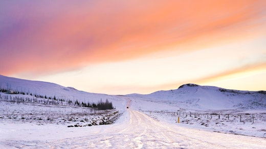
Domain of the Norse thunder god, Thor, and shaped by fire and ice, Iceland’s volcanic landscape is a spectacular collage of lava fields, craters, waterfalls, and imposing mountain ranges. Vast geothermal springs power the spray of geysers, provide residents with the hot water that heats their homes, and fills the warm public pools where locals go to relax and catch up with friends. Visitors are encouraged to join in the fun. Reykjavik itself is a 21st century European city, with fine restaurants, cozy cafes, and intriguing museums and galleries.
227/7/25Heimaey, Westman Islands, Iceland
328/7/25At Sea
429/7/25Umivik
530/7/25
Situated in the heart of the Norwegian fjords, the port of Skjolden-Sognefjord is your gateway to a world of wonder: this land abounds with national treasures, thundering waterfalls, two UNESCO sites, ice-blue fjords hemmed in by sky-reaching mountains and scenery so unbelievably spectacular you just may lose your breath. From the ruggedly handsome mountains in Jotunheimen National Park to the humble stave churches that dot the landscape, this captivating area is yours to discover.
631/7/25At Sea
631/7/25
Tiny Aappilattoq is located in the Prince Christian Sound at Greenland’s southern tip, in the municipality of Kullaleq. Its name means ‘red’ in Greenlandic. The sound is enfolded by steep, unglaciated mountains, rising sheer from the water to sharp, shattered peaks. The town’s setting is particularly picturesque, its brightly painted houses scattered across a small peninsula of humped granite domes, under a backdrop of a looming pyramid of stone. The little red town church nestles next to a white-picketed graveyard. The sound itself is dotted with icebergs slowly melting into expressionist sculptures. It is a place where the infrequent visitors routinely fill their camera cards with unforgettable images of Greenland’s spectacular visual splendor.
71/8/25
The largest town in South Greenland with over 3,500 citizens, Qaqortoq was founded in 1775 and still reveals some examples of colonial-period architecture. There is not infrastructure to support shore excursions here, but guests can explore the town and its museum, or possibly arrange a visit to a nearby hot springs. Like other towns in Greenland, there are also possibilities to buy examples of traditional Inuit arts and crafts, including items crafted of bone, soapstone and wild-harvested furs.
71/8/25
Twelve miles by Zodiac up the Hvalseyjarfjord from Qaqortoq, the largest community in South Greenland, lies the most prominent Norse archaeological site in Greenland. The so-called Eastern Settlement lasted from the 10th until the mid-15th century. Your expedition team archaeologist can interpret for you the ruins of the great halls and church at Hvalsey that hint of a prospering medieval farmstead. The site evokes an era when the Norse were trading with the indigenous Thule people of the area for furs and ivory, which were a prized commodities in Europe. A wedding held in the church in 1408 comprises the last written record of the Norse adventure in Greenland. Within a few years, Hvalsey and the rest of other Norse communities of Greenland withered as immigrants returned to the more established communities in Iceland and Norway. The site’s meadows of wildflowers sloping up from the fjord give a sense of the peaceful community that existed here in that long-ago summer.
82/8/25At Sea
93/8/25
Greenland’s capital boasts some 16,000 inhabitants. Although the town does not offer us any shore excursions, there are several attractions which guests may wish to visit. One is the roofed town market, where the products of the nearby sea and wilderness are for sale, including the meat of whales, seals, birds and fish. The Katuaq Cultural Center offers changing exhibitions. Especially worth a visit is the National Museum, which besides many historic objects, contains the quite famous 500-year old mummies recovered from Qilakitsoq. The nearby Museum of Art has works by both Inuit and Nordic artists. There is also an artisan’s center where guests may purchase locally produced works, and a collection of traditional houses.
104/8/25At Sea
115/8/25Evighedsfjorden
126/8/25Sisimiut (Holsteinsborg), Greenland
137/8/25
Kangerlussuaq is a settlement in western Greenland in the Qeqqata municipality located at the head of the fjord of the same name (Danish: Søndre Strømfjord). It is Greenland's main air transport hub and the site of Greenland's largest commercial airport. The airport dates from American settlement during and after World War II, when the site was known as Bluie West-8 and Sondrestrom Air Base. The Kangerlussuaq area is also home to Greenland's most diverse terrestrial fauna, including muskoxen, caribou, and gyrfalcons. View less The settlement's economy and population of 512 is almost entirely reliant on the airport and tourist industry.
148/8/25At Sea
159/8/25
Located in Disco Bay, Ilulissat is home to Sermeq Kujalleq, the fastest-moving glacier in the world. This tremendous river of ice flows from the Greenland Ice Shield toward the sea, funneling through a narrow opening at nearly 40 meters a day. Designated a UNESCO World Heritage Site, it is the “Mother of Icebergs” that fills its fjord and the bay with great quantities of floating icebergs that parade down the bay and into the Atlantic Ocean. No formal excursions are planned for the town, which is home to about 4,600 people and some 3,500 sled dogs.
1610/8/25Sisimiut (Holsteinsborg), Greenland
1711/8/25At Sea
1812/8/25Pond Inlet
1913/8/25At Sea
2014/8/25
Croker Bay is a 35 kilometer (20 miles) deep fjord on the southern shore of Devon Island and is flanked by colorful 450 metre (1,500’) high table-like mountains. The tidewater glacier at its head descends 20 kilometers (12 miles) from the icefield at the center of the island and terminates in spectacular cliffs of ice. Some 3.5 kilometers (2 miles) wide, the glacial front calves huge amounts of ice into the bay. Here polar bears, seals and even a pod of beluga whales can be seen travelling amongst the brash ice. To the east is the abandoned community of Dundas Harbour. The derelict buildings of the R.C.M.P. post are all that remain and serve as a silent reminder to the 52 Inuit that came here in 1934. Here, set amongst a landscape aglow in the colors of Arctic Autumn, lay the stark white crosses and picket fence enclosure of one of the most northerly cemeteries on Earth. Nearby, 1,000 year old stone remains of earlier Inuit settlers can be found.
2014/8/25
Croker Bay is an Arctic waterway in Qikiqtaaluk Region, Nunavut, Canada. It lies off the southern coast of Devon Island in the eastern high Arctic. Like Maxwell Bay to the west, it is an arm of Lancaster Sound and Barrow Strait. The abandoned Dundas Harbour is 32.1 miles to the east.
2115/8/25At Sea
2216/8/25At Sea
2317/8/25Gjoa Haven
2418/8/25At Sea
2519/8/25At Sea
2620/8/25At Sea
2721/8/25At Sea
2822/8/25At Sea
2923/8/25Sachs Harbour
3024/8/25At Sea
3125/8/25At Sea
3226/8/25At Sea
3327/8/25
Nome is located on the edge of the Bering Sea, on the southwest side of the Seward Peninsula. Unlike other towns which are named for explorers, heroes or politicians, Nome was named as a result of a 50 year-old spelling error. In the 1850's an officer on a British ship off the coast of Alaska noted on a manuscript map that a nearby prominent point was not identified. He wrote "? Name" next to the point. View less When the map was recopied, another draftsman thought that the “?” was a C and that the “a” in "Name" was an o, and thus a map-maker in the British Admiralty christened "Cape Nome." The area has an amazing history dating back 10,000 years of Inupiaq Eskimo use for subsistence living. Modern history started in 1898 when "Three Lucky Swedes”, Jafet Lindberg, Erik Lindblom and John Brynteson, discovered gold in Anvil Creek…the rush was on! In 1899 the population of Nome swelled from a handful to 28,000. Today the population is just over 3,500. Much of Nome's gold rush architecture remains.
3428/8/25
Nome is located on the edge of the Bering Sea, on the southwest side of the Seward Peninsula. Unlike other towns which are named for explorers, heroes or politicians, Nome was named as a result of a 50 year-old spelling error. In the 1850's an officer on a British ship off the coast of Alaska noted on a manuscript map that a nearby prominent point was not identified. He wrote "? Name" next to the point. View less When the map was recopied, another draftsman thought that the “?” was a C and that the “a” in "Name" was an o, and thus a map-maker in the British Admiralty christened "Cape Nome." The area has an amazing history dating back 10,000 years of Inupiaq Eskimo use for subsistence living. Modern history started in 1898 when "Three Lucky Swedes”, Jafet Lindberg, Erik Lindblom and John Brynteson, discovered gold in Anvil Creek…the rush was on! In 1899 the population of Nome swelled from a handful to 28,000. Today the population is just over 3,500. Much of Nome's gold rush architecture remains.
CALL
Call to speak with one of our cruise specialists on 0330 094 0218